By Jacob Koshy
What is it?
First, it helps to get a sense of how cyclones move. The ones that typically strike the Indian neighbourhood in the northern hemisphere rotate anticlockwise. Their normal behaviour is to derive strength from the moisture in waters such as the Bay of Bengal, move west, incline in a northerly direction and peter out into the sea or land, depending on their origin.
This is how you would explain a regular cyclone, say like Mora, which formed over the Bay of Bengal on May 26. It rapidly strengthened on May 28, with the India Meteorological Department classifying it as a “depression” and eventually as a cyclonic storm. It kept north, almost parallel to the Myanmar coast and then made landfall in Bangladesh and blew over Nagaland. In a re-curving cyclone, the cyclone gets a sort of second wind when it is on the wane.
Like the googly in cricket, it’s deflected right or eastwards. This is due to air currents in the local atmosphere that push cold air from the poles towards the equator and interfere with cyclone formation. That’s what make them ‘re-curving.’ In the southern hemisphere, the cyclones spin clockwise and therefore also re-curve in the opposite direction.
How do they come about?
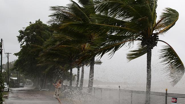
During the monsoon months, cyclones in the Western Pacific move westwards towards India and aid the associated rain-bearing systems over the country. However, in the years of a re-curve, they do not give as much of a push to the rain as they do in the good monsoon years and that is why monsoon rain this August was a dampener. Rain that month was 13% short of what is usual and meteorologists say it was almost certainly because of an active hurricane season in the Pacific that consisted of a few re-curving cyclones. However, these are back in the news due to Cyclone Ockhi. The whirlwind that arose in the Bay of Bengal and revved up over Sri Lanka was expected to pass over Lakshadweep and then ease into the Arabian Sea, far away from India’s west coast.
However, the cyclone ended up sharply swerving into parts of Maharashtra and Gujarat. It did not blow in very strongly because there it had not gained as much moisture from the Arabian Sea like it had over the Bay of Bengal and the Indian Ocean boundary. And though it wreaked havoc in Kerala and Tamil Nadu, even a weakened Ockhi destroyed several beaches in Goa when it curved back to the land.
Why does it matter?
Long-term data suggest that while there has been an increase in the number of tropical cyclones in India’s neighbourhood there is no clear trend in re-curving ones. In general, cyclone activity in India peaks around November, by which time, the summer monsoon has already passed. Rarely do re-curving cyclones pose a mortal threat to Indian coasts and Cyclone Ockhi raised hackles because it had already left a certain amount of damage and threatened Gujarat and Maharashtra. It was also among the rare curving cyclones with a presence over the Arabian Sea.
What lies ahead?
As climate change is projected to increase the frequency of extreme events, scientists have warned that tropical cyclones are likely to get more intense, and this could mean more scrutiny of re-curving ones. A challenge with re-curving cyclones is that it is hard for weather models to pick them early on — as was the case with Ockhi — and so they pose unique challenges in terms of hazard preparedness and disaster management.
Source: The Hindu

Leave a Reply